Stop wasting time searching for fish and start catching them
with 36 years of proven, hard-earned local knowledge. This exclusive GPX Data
Package delivers the exact coordinates of a lifetime of successful fishing.
Whether you are navigating the shallow flats of the Nature
Coast or running deep into the blue waters of the Florida Keys, this map plugs directly into your chart plotter to put you right on the bite.
🎣 What You Get: Two
Legendary Fisheries in One File.
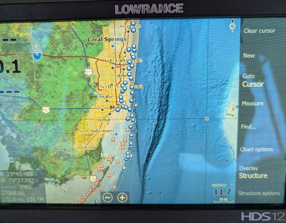
• 22 Years of Crystal River Secrets: Master the Nature Coast
with pinpoint coordinates for hidden rockpiles, shallow redfish flats,
trout-heavy grass beds, and offshore grouper ledges.
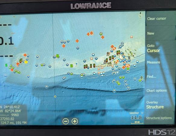
• 14 Years of Key West Hotspots: Navigate the ultimate
fishing paradise with proven coordinates for elite reef drops, productive
wrecks, tarpon channels, and blue-water pelagic highways. Includes both
public and my secret hot spots, OVER 4000 waypoints in total.
• GPX Digital Download sent to your E-mail: No manual typing required. These
standardized .GPX files upload instantly into your favorite Marine Electronics
(Garmin, Lowrance, Simrad, Humminbird, Raymarine) or mobile navigation apps
like Navionics and Google Earth.
⚓ Why Trust This Data?
• 36 Years of Experience: This isn’t a collection of just
public data found online. These are private, highly curated waypoints built
from decades of actual time on the water.
• Zero Guesswork: Skip the blank screens and dead zones.
Head straight to structures that hold target species year-round.
• Plug-and-Play Simplicity: Upload and watch your map light up with premium
honey holes.
Will every spot have fish. NO, and the reasons could be a multiple factors listed below:
• Water Temperature and Weather: Fish move to deeper water
or hide when the water is too hot, too cold, or after a heavy storm that stirs
up the sand.
• Tide and Current: Many reef fish feed actively only when
the water is moving; slack tide (when the water is still) often makes them
inactive and hidden.
• Time of Day: Early morning and late evening are best;
bright midday sun drives many reef species deep into crevices and caves.
• Overfishing and Pressure: Heavy fishing or boat traffic in
popular spots scares fish away or depletes local populations.
• Habitat Degradation: Dead or damaged coral offers less
food and shelter, causing fish to leave the area.
How to succeed.
• Map a logical path: Arrange your coordinates in a
continuous line from your launch point to avoid zig-zagging across the water. • Identify target structure with a depth finder. If the structure has sunk, degraded, been buried over time, and sonar does not mark any fish, move to the next coordinate.
• Set time limits: Give each coordinate a set window (e.g.,
10 to 15 minutes). If you do not get a bite or see activity on your fish
finder, move to the next coordinate.
• Account for tides and wind: Plan which coordinates to
visit first based on water movement; current-driven or tide-sensitive spots
should be timed with the peak of the tide cycle.
• Log and Adjust Data while on the Water.
• Record environmental notes: Write down water temperature,
clarity, weather, and time of day for each stop.
• Prune unproductive spots: If a coordinate fails to produce
fish after multiple tries under different conditions, remove it or lower its priority.
• Mark new discoveries: Drop new waypoints immediately when
you spot unexpected bait concentrations or bottom changes.
GPX Digital Download sent to your E-mail.
You are getting 36 years of my hard earned experience, best of luck and tight lines.