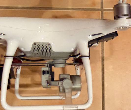
This DJI Phantom 4 RTK+D-RTK 2 Mobile Station Combo, Model #WM334R, is a compact and accurate low altitude mapping solution that provides centimeter-accurate data while requiring fewer ground control points.
The Vietnam Veteran who owned this drone, and another drone that is also available (Phantom 4 Advanced, Model #WM332A, with Sony Multispectral Camera - MSZ-2100G, listed separately), he no longer could work for health reasons and he donated these two complete drone kits to our Military and 1st Responder charitable foundation, LevelONE Foundation (www.L1F.org), to raise funds for our Suicide Prevention and Crisis Intervention programs and services. So, please keep that in mind as you consider purchasing one or both of these beautiful drones. Neither of these drones have much flying time at all. Practically new.
NOTE: It is up to the buyer to register the drone, aquire any and all licenses, or other regulatory requirements to operate these drones.
CENTIMETER-LEVEL ACCURACY:
Integrated RTK module delivers real-time positioning data for survey-grade results with ±1cm horizontal accuracy.
ADVANCED IMAGING SYSTEM:
1-inch, 20MP CMOS sensor with a mechanical shutter ensures high-resolution, distortion-free images.
INTELLIGENT FLIGHT PLANNING:
GS RTK app supports Photogrammetry, Waypoint Flight, Terrain Awareness, and more for efficient mission planning.
STABLE TRANSMISSION:
OcuSync provides reliable HD image and video transmission over distances up to 7 km.
SEAMLESS WORKFLOW INTEGRATION:
Compatible with D-RTK 2 Mobile Station and third-party SDK apps for diverse surveying and mapping needs.
KEY FEATURES:
- Enterprise-Level Drone Mapping Solution
- 1cm+1ppm RTK Horizontal Accuracy
- 1.5cm+1ppm RTK Vertical Accuracy
- Distortion Calibrated 1" CMOS Sensor
- 16GB MicroSD Card Slot
- TimeSync Alignment for Accurate Metadata
- Controller with Display and GS RTK App
- Photogrammetry & Waypoint Flight Modes
- OcuSync for up to 4.3-Mile Streaming
- Up to 30 Minutes Flying Time
CENTIMETER-LEVEL POSITIONING SYSTEM
An RTK module is integrated directly into the Phantom 4 RTK, providing real-time, centimeter-level positioning data for improved accuracy on image metadata. In addition to optimized flight safety and precise data collection, the Phantom 4 RTK stores satellite observation data to be used for PPK.
GATHER ACCURATE DATA WITH TIMESYNC
The TimeSync system continually aligns the flight controller, camera and RTK module. Additionally, TimeSync ensures each photo uses the most accurate metadata and fixes the positioning data to optical center of the lens – optimizing the results from photogrammetric methods and letting the image achieve centimeter-level positioning data.
PRECISE IMAGING SYSTEM
Capture the best image data with a 1-inch, 20-megapixel CMOS sensor. Mechanical shutter makes mapping missions or regular data capture seamless as the Phantom 4 RTK can move while taking pictures without the risk of rolling shutter blur. Due to the high resolution, the Phantom 4 RTK can achieve a ground sample distance (GSD) of 2.74 cm at 100 meters flight altitude.
BUILT FOR SURVEYORS
Offering a range of control schemes and complementary technologies, the DJI Phantom 4 RTK is developed to provide survey-grade results with greater efficiency than ever before.
D-RTK 2 HIGH PRECISION GNSS MOBILE STATION w/ TriPod
Support your Phantom 4 RTK missions with the D-RTK 2 Mobile Station – providing real-time differential data to the drone and forming an accurate surveying solution, or acquire accurate location coordinates when used as an RTK rover. The Mobile Station’s rugged design and OcuSync transmission system ensures you can gain centimeter-level accurate data with your Phantom 4 RTK in any condition.
MOBILE STATION KIT INFO LINK:
https://flyingag.com/products/dji-d-rtk-2-high-precision-gnss-mobile-station-w-tripod?variant=44042036904093&country=US¤cy=USD&utm_medium=product_sync&utm_source=google&utm_content=sag_organic&utm_campaign=sag_organic&utm_term=&utm_campaign=*PMAX+Shopping+Campaign+-+Flying+AG&utm_source=adwords&utm_medium=ppc&hsa_acc=2761599058&hsa_cam=21022291809&hsa_grp=&hsa_ad=&hsa_src=x&hsa_tgt=&hsa_kw=&hsa_mt=&hsa_net=adwords&hsa_ver=3&gad_source=1&gad_campaignid=21029137394&gbraid=0AAAAAojmAtKAQL6wCi3ZoURXu1cAiICKl&gclid=Cj0KCQjwlerQBhDMARIsAB16H-XeMYKYFdOX7TWEqtCrjN22LUf3_dzRa6IfWNXQLz5MU_hDnrZtRZEaAn2OEALw_wcB
KIT INCLUDES:
DJI Phantom 4 RTK Quadcopter with RTK Controller
GPC Go Professional Case ($600 retail alone)
Remote Controller with HD Display
16 GB MicroSD Card
4 x Pair of Propeller Blades
3 x Intelligent Flight Batteries
4 x Remote Controller and Mobile Station Intelligent Batteries
Intelligent Battery Charging Hub
Intelligent Flight Battery Charging Hub
Gimbal Clamp
AC Power Cable
AC Power Adapter
DJI D-RTK 2 Mobile Station
DJI D-RTK 2 Tripod
Orange Launch and Landing Pad
PRICES:
Phantom 4 RTK+D-RTK2 Mobile Station Combo Kit for Mapping, Model #WM334R++ $2,600
Phantom 4 Advanced Quadcopter Kit for Agricultural Uses, Model #WM332A++ $1,900
(see seperate posting for the Advanced unit kit only)
PACKAGE PRICE FOR BOTH KITS $4,500
CHECK OUT ALL OF THE OTHER GREAT ITEMS OUR CHARITABLE FOUNDATION HAS AVAILABLE! CLICK ON THE “More Ads by this User” BUTTON AND TAKE A LOOK.