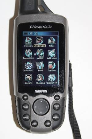
GARMIN - 60CSx (Satellite Receiver) (Camping , Sailing , Traveling Navigation Tool)
Global Positioning System - made in Taiwan -
Designed to Display Global Coordinates/Altitude for (Camping , Sailing, Traveling)
Garmin GPSMAP 60CSx features multiple operational modes for navigation, including map panning, electronic compass, barometric altimeter tracking, and trip computer data to store waypoints, create routes, and save tracks for retracing steps.
Key modes include GPS Normal, WAAS enabled for high accuracy, and power-saving options, alongside tracking, routing, and route-tracing capabilities for outdoor navigation.
Core Operational Modes
Position Mode (Map Page): Displays your current position and tracks your movement, allowing you to view your path.
Pan Mode: Activated by using the rocker key to move the map pointer, letting you pan around the map.
Compass Mode: Uses the electronic compass to provide direction to a destination (60CSx specific).
Altimeter Mode: Tracks elevation changes and barometric pressure, allowing you to view elevation profiles.
Trip Computer Mode: Displays trip navigation data such as speed, distance, and time.
Map Orientation Modes:
Track Up: Orients the map in the direction of travel.
North Up: Orients the map with North at the top.
System & GPS Modes
Normal (GPS): Receives satellite signals and updates position every second.
WAAS Mode: Enabled for high-accuracy positioning (within 3 meters).
Auto-Locate Mode: Used when the unit is turned on for the first time or moved long distances, allowing it to find its location.
Battery Saver Mode: Reduces the update rate to conserve power