Parcel Number: 009-371-34
Property Description: 160 Acres in Churchill County, NV
Street Name: TBD
Size: 160 Acres
GPS Coordinates to Center: 39.6028, -118.8618
GPS NW Corner: 39.6064, -118.8666
GPS NE Corner: 39.6064, -118.8570
GPS SW Corner: 39.5991, -118.8667
GPS SE Corner: 39.5991, -118.8571
Elevation: 3948 feet
County and State: Churchill County, Nevada
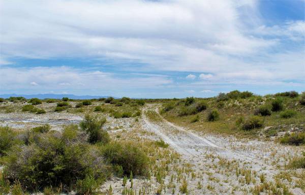
Views From Property: Beautiful Mountain Views!
Terrain: Flat to rolling. Sage and natural grasses.
Land Use Code: 100
Zoning Code: RR20
Water: A well will be needed.
Sewer: A septic will be needed.
Power: 3.06 miles from SE corner of property
Nearest Road: 136 feet from SW corner of property
Nearest Major Freeway: 4.18 miles from HWY 95, 14.14 miles from I80
Time Limit to Build: None
Tax Per Year: $120.41
7.33 miles from HWY 50, 9.83 miles from Fallon, 20.57 miles from Fernley, 4.95
miles from Soda Lake, 6.06 miles from Little Soda Lake, 6.22 miles from Mud
Lake, 6.92 miles from West Fork of Old River, 7.17 miles from Carson River, 3.44
miles from Railway.